About this app
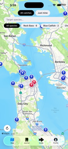
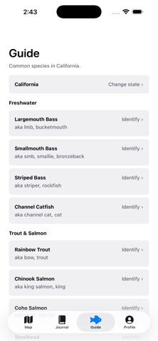
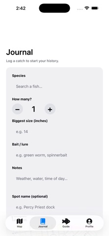
BiteMap is a fishing map built the way anglers actually wanted one: free where it should be free. WHERE ARE THE FISH? See a live heat map blending real catches logged by other anglers with documented species-occurrence data from public science sources (USGS, GBIF) — so the map is never empty, even in a brand-new area. Blue pins mean a species is known to live there; red, hot pins mean someone's actually caught fish there recently. LOG A CATCH IN SECONDS Species, count, size, bait, and a note — plus your location, automatically. Keep it private or share it to the map to help other anglers (and yourself, next season). IDENTIFY WHAT YOU CAUGHT A built-in identification guide covering all 50 states and 40+ species, with real distinguishing features, typical size, and where to find each one — not just a photo. FOLLOW YOUR FISHING FRIENDS See what your friends are catching and where (when they choose to share it), and build your own following. NO PAYWALL AT LAUNCH Your account, catch logging, journal, the full ID guide, and following friends are free — not a trial, not a teaser. That's not changing anytime soon. Built for anglers who are tired of apps that gate the basics behind a monthly fee.
Audience growth
Ratings growth
Baseline captured. Growth appears after the crawler observes a changed rating count.
Momentum comes from crawler snapshots for the tracked storefront. “Viral growth signal” means unusually fast recent rating gains; it is an indicator, not download data.
Price tracking
Price intelligence
First snapshot captured. The trend line starts after the next crawler price observation.
- First observed Sep 4, 2026 · 6:54 PM Free
Screenshots