About this app
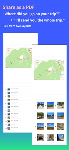
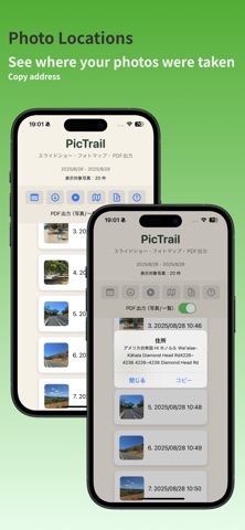
PicTrail is a photo map app that lets you log and view your travel photos along your routes on a map. Photos from your trips and everyday moments are automatically organized by date and time, using location information. You can follow your photo routes to see where you went and how you moved from place to place. Enjoy your travel memories as a slideshow, and save or share your story as a PDF. No complicated steps — just select a date or your photos, and PicTrail automatically does the rest. ▼ Main features ・Automatically organizes photos by date and time ・Shows photo locations and routes on a map ・Plays photos as a slideshow ・Saves and shares photo lists as a PDF
Latest release
What’s New
Improved time zone handling based on photo locations for more accurate photo and map display across different regions. Also includes stability improvements and minor bug fixes.
Audience growth
Ratings growth
Baseline captured. Growth appears after the crawler observes a changed rating count.
Momentum comes from crawler snapshots for the tracked storefront. “Viral growth signal” means unusually fast recent rating gains; it is an indicator, not download data.
Price tracking
Price intelligence
First snapshot captured. The trend line starts after the next crawler price observation.
- First observed Aug 23, 2026 · 4:50 PM Free
Screenshots